
By
Super User
Best Travel Guide To Rwenzori Mountains Hiking/Climbing In Uganda
Best Travel Guide To Rwenzori Mountains Hiking/Climbing In Uganda
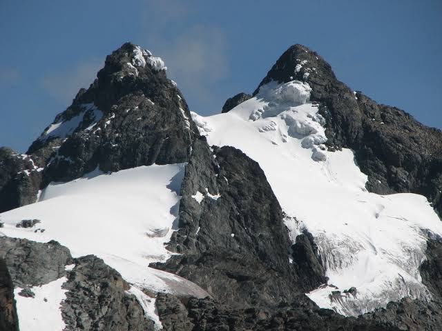
Hiking the Rwenzori Mountains in Uganda is one of the most exciting and challenging mountain ranges to trek in the world. The Rwenzori lies along the Uganda-DR Congo border in western Uganda. The highest peak of the Ruwenzori reaches 5,109 meters (16,762 ft.), and the range's upper regions are permanently snow-capped and glaciated. Rivers fed by mountain streams form one of the sources of the Nile. Because of this, European explorers linked the Rwenzori with the legendary Mountains of the moon.
Mount Rwenzori's Massifs;
The Rwenzori Mountains are the highest non-volcanic, non-orogenic mountains in the world. The range is about 120 kilometres (75 mi) long and 65 kilometres (40 mi) wide. It consists of six massifs separated by deep gorges: Mount Stanley (5,109 metres (16,762 ft)), Mount Speke (4,890 metres (16,040 ft)), Mount Baker (4,843 metres (15,889 ft)), Mount Emin (4,798 metres (15,741 ft)), Mount Gessi (4,715 metres (15,469 ft)) and Mount Luigi di Savoia (4,627 metres (15,180 ft)). Mount Stanley has several subsidiary summits, with Margherita Peak being the highest point.
Rwenzori Trekking offers a variety of trekking and climbing options from one day to twelve days to suit your style of adventure and schedule. The Rwenzori range is a true mountain range with many climbs and descents making it a tough climb however the scenery and beautiful vegetation are incredible.
Mount Rwenzori Hiking Trails;
There are two main trek routes in Rwenzori Mountains National Park: the Central Circuit Trail and the Kilembe Route. The Central Circuit Trail enters the mountain range from the east and does a large, anticlockwise loop.
The low-altitude treks won't take you beyond 4,000 metres and typically last 2-4 days. High-altitude treks take you to peaks above 4,000 metres and last between 4-12 days.
The Kilembe trailhead lies at the head of Nyamwamba Valley, 15 km west of Kasese town. The central circuit trailhead is located in the Mobuku Valley at Mihunga, 22 km from the Fort Portal-Kasese road, 25 km north of Kasese town. There is also the Bukurungu trailhead located at Katebwa, off the main road at Nyakigumba, 6 km from the mid-way between Kasese and Fort Portal towns.
Rwenzori trekking services (RTS) operates the Kilembe trail which enables 9-day trekking to summit Mount Stanley and there is a shorter 6-day option to the more accessible, but equally scenic, Mount Luigi di Savola. The central circuit trek takes approximately 7 days. The Bukurungu trail ascends from Kitumba to Mount Gessi. The Mount is best climbed during the drier months of January, and June to July.
The highest peaks on the Rwenzori’s six summits can all be climbed and the most popular is the 5,109 meters Margherita peak, the highest point on Mount Stanley and the rooftop of Rwenzori. An ascent of Mount requires a minimum of 7 days of trekking. The real appeal of the Rwenzori is the opportunity to hike through superb mountain scenery featuring patches of equatorial snow and outlandish vegetation, grandstand views of the summits, scenic views of Lake Mahoma in the bamboo forest, plateaus, semuliki valley and other attractive features.

The lower slopes of Rwenzori feature forests that are perfect for nature walks and birding and are also host to the famous Rwenzori National Park. The park can be visited via the Kilembe and Nyakalenja trailheads. Conveniently for bird lovers, the park is a habitat for many bird species including the Rwenzori turaco, Rwenzori batis, Rwenzori nightjar, handsome francolin and others.
The Rwenzori is also a habitat for the unique 3-horned chameleon and Rwenzori colobus monkey.
Arrange with Ultimate Wild Safaris for a beautiful trek of Rwenzori Mountain in western Uganda.
Email: This email address is being protected from spambots. You need JavaScript enabled to view it.
Mobile: +256 705 087 906 / 760 282 342


